Mapping Remote Oregon: An OpenStreetMap Project (2017)
Purpose
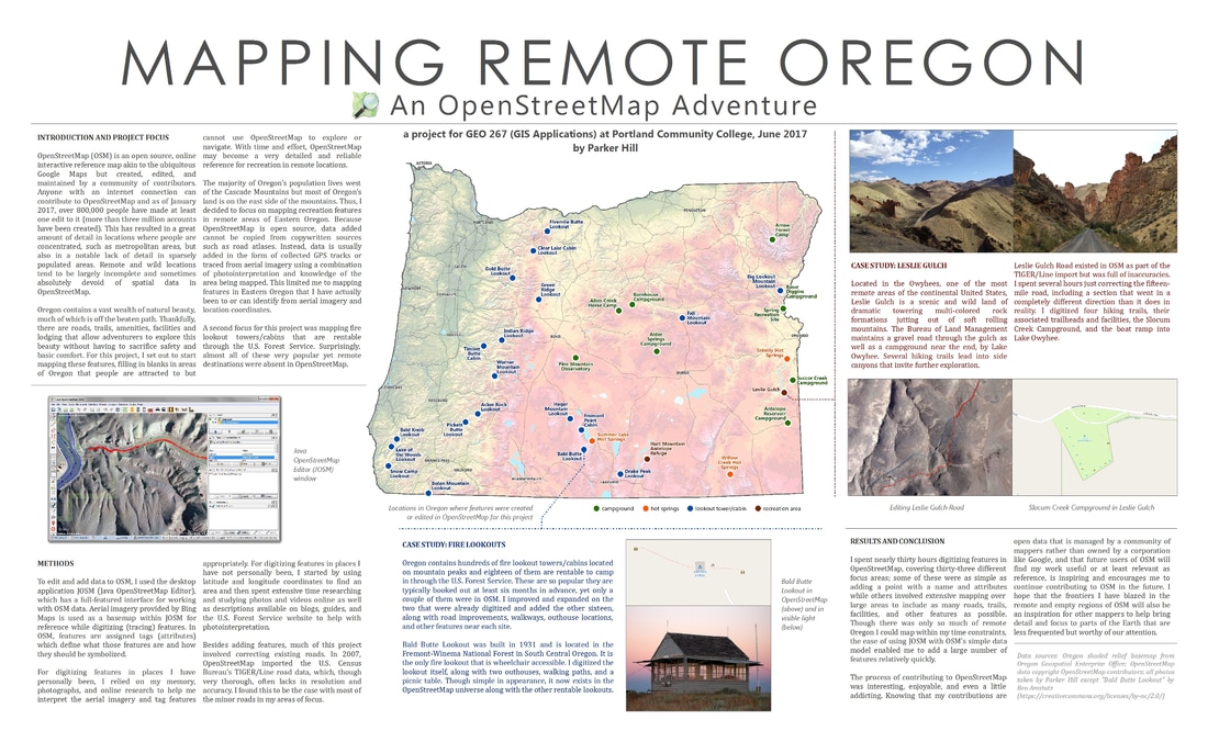
Provides an overview of a project in which recreational data in remote locations of Oregon was uploaded to OpenStreetMap. Poster designed for a GIS Applications course at Portland Community College.
Methodology
Data contributed to OpenStreetMap was digitized using the application JOSM and poster layout was created in ArcMap. Oregon map was designed using a shaded relief raster available from Oregon Geospatial Enterprise Office. Cartographic techniques include customized label annotation and callouts; magazine-like layout contains integrated photographs and screenshots.
Specifications
24 x 39 inches, color.
Purpose
Provides an overview of a project in which recreational data in remote locations of Oregon was uploaded to OpenStreetMap. Poster designed for a GIS Applications course at Portland Community College.
Methodology
Data contributed to OpenStreetMap was digitized using the application JOSM and poster layout was created in ArcMap. Oregon map was designed using a shaded relief raster available from Oregon Geospatial Enterprise Office. Cartographic techniques include customized label annotation and callouts; magazine-like layout contains integrated photographs and screenshots.
Specifications
24 x 39 inches, color.
